Mount Kilimanjaro stands as Africa's crowning glory, piercing the sky at an impressive 5,895 metres (19,341 feet). This comprehensive guide explores everything you need to know about this magnificent mountain, from its geological formation to practical climbing advice.
The Geographical Marvel of Mount Kilimanjaro
Location and Accessibility
Mount Kilimanjaro stands majestically in northern Tanzania, dominating the landscape of East Africa. When people ask "where is Mount Kilimanjaro" or "what country is Mount Kilimanjaro in", the answer lies in Tanzania's northeastern region, near the border with Kenya. Specifically, Mount Kilimanjaro's location on map coordinates are 3°04'33"S 37°21'12"E, placing it approximately 300 kilometres south of the equator.
The mountain's accessibility contributes to its popularity as a climbing destination. Kilimanjaro International Airport serves as the primary gateway, situated between the towns of Moshi and Arusha. These urban centres provide essential services and accommodation for visitors planning to climb the mountain. The question of "where is Mount Kilimanjaro located in Tanzania" is often answered by referencing these nearby towns, particularly Moshi, which serves as the main base for climbing expeditions.
The mountain's location within Mount Kilimanjaro National Park creates a protected zone covering 1,688 square kilometres. This designation as a national park, established in 1973, ensures the preservation of the mountain's unique ecosystems and manages tourist access effectively. The park's boundaries encompass not only the mountain itself but also the surrounding forests and alpine regions.
Surrounding Geography
The surrounding landscape presents a remarkable contrast of environments and elevations. At the base, fertile volcanic soils support extensive agricultural activities, where local communities cultivate crops such as coffee, bananas, and maize. This agricultural belt gradually gives way to natural forest zones as the elevation increases.
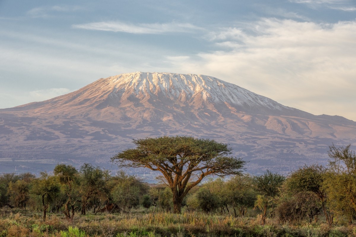
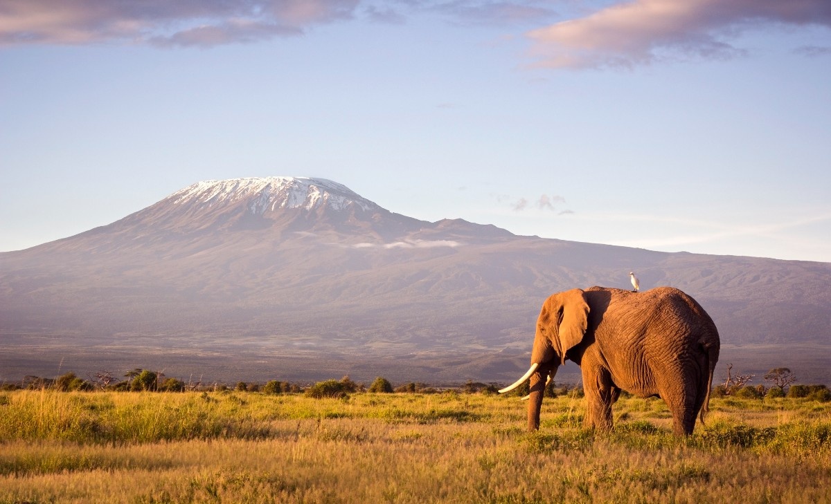
Mount Kilimanjaro in Africa stands as a free-standing mountain, making it particularly impressive in terms of its visual impact and geographical significance. Unlike mountains that form part of ranges or chains, Kilimanjaro rises in splendid isolation from the surrounding plains, emphasising its massive scale and dominance of the landscape.
Geological Formation and Volcanic History
Volcanic Origins
The story of Mount Kilimanjaro's formation begins approximately one million years ago during the Pleistocene epoch. The mountain emerged through volcanic activity associated with the Great Rift Valley system, which continues to shape East Africa's landscape. Understanding "how big is Mount Kilimanjaro" requires examining its volcanic composition, which comprises three main volcanic cones: Kibo, Mawenzi, and Shira.
These cones developed sequentially, with Shira being the oldest, followed by Mawenzi, and finally Kibo. Each cone represents a distinct phase in the mountain's volcanic history, contributing to its current form and Mount Kilimanjaro elevation. Today, while Mawenzi and Shira are extinct, Kibo remains dormant, occasionally releasing steam and sulphur gases through fumaroles in its crater.
Physical Characteristics
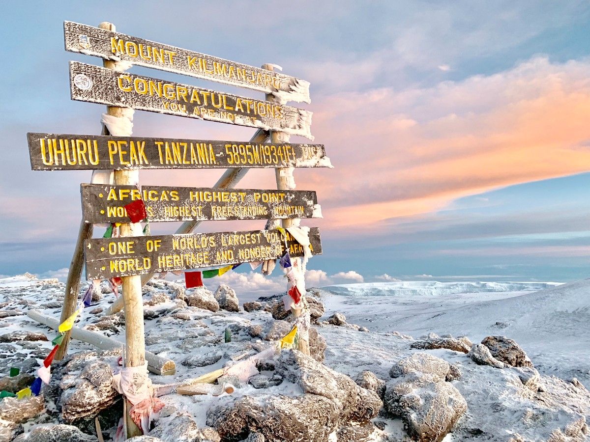
When discussing "how high is Mount Kilimanjaro", the statistics are impressive. The mountain reaches an elevation of 5,895 metres (19,341 feet) at its highest point, Uhuru Peak on the Kibo crater rim. This makes it not only the highest point in Africa but also the world's highest free-standing mountain. The question "how tall is Mount Kilimanjaro in Africa" emphasises its significance as the continent's premier peak.
The mountain's physical structure includes various geological features that tell its formation story. The Kibo crater, known as the Reusch Crater, measures approximately 2.5 kilometres in diameter, containing the Inner Crater and the Ash Pit. These features provide essential information about the mountain's volcanic activity and history.
Glacial Features
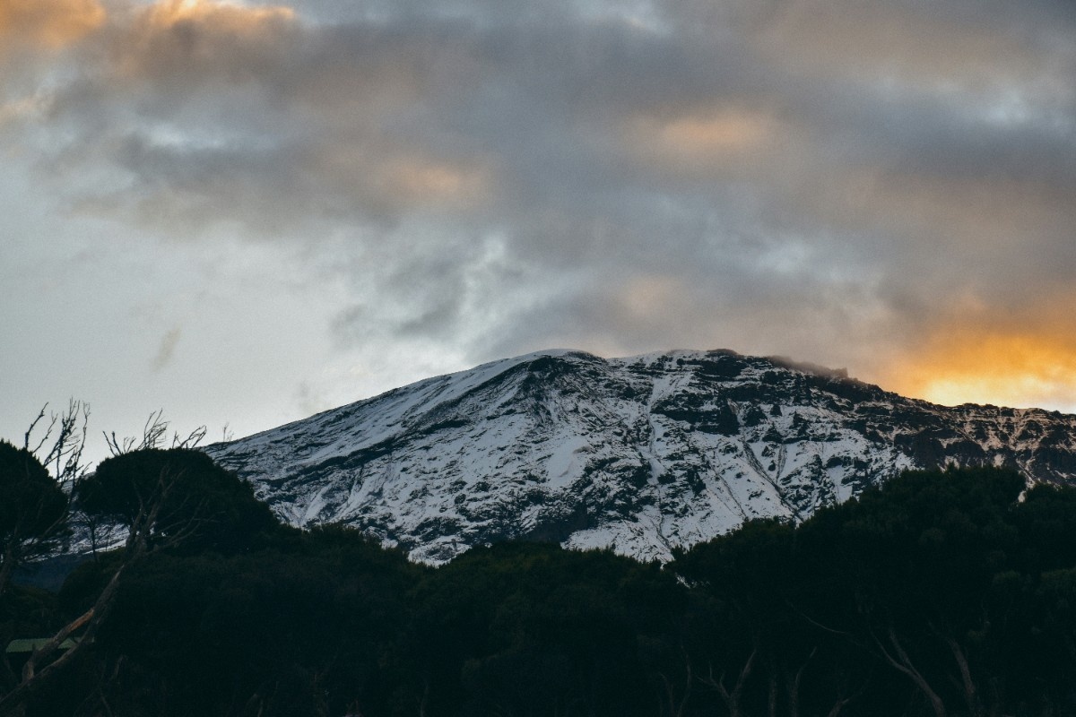
One of the most remarkable aspects of Mount Kilimanjaro is its glaciers, which have existed for thousands of years despite the mountain's proximity to the equator. These ice fields represent an unusual geological phenomenon, though they have been retreating significantly since the early 20th century due to climate change.
The glaciers formed during the last ice age, when colder temperatures allowed for the accumulation of snow and ice at the summit. Today, these remaining ice fields provide crucial evidence of historical climate patterns and current environmental changes. Their presence also influences local weather patterns and water resources, making them an integral part of the mountain's geological and ecological systems.
Climate and Weather Patterns
Seasonal Variations
Understanding Mount Kilimanjaro weather patterns is crucial for anyone planning to climb this majestic peak. The mountain experiences two distinct wet seasons: the long rains from March to May and the short rains from November to December. These seasonal patterns significantly influence climbing conditions and success rates for those attempting to reach the summit.
During the wet seasons, precipitation is more pronounced on the southern and eastern slopes, while the northern and western faces typically receive less rainfall. This variation creates diverse microclimates around the mountain, affecting both the local ecosystems and climbing conditions. Despite the seasonal rains, climbing Mount Kilimanjaro remains possible throughout the year, though many choose to avoid the peak wet seasons.
The dry seasons, occurring from January to February and June to October, typically offer more stable conditions for climbing. During these periods, clearer skies provide better visibility and more predictable weather patterns, making them popular times for expeditions. However, even during these supposedly dry periods, climbers should be prepared for varying weather conditions as mountain weather can be unpredictable.
Temperature Zones
The temperature variations on Mount Kilimanjaro present one of the most fascinating aspects of its climate. At the base of the mountain, temperatures typically range between 20°C and 30°C (68°F to 86°F). However, as climbers ascend, they experience dramatic temperature changes that reflect the mountain's varied elevation zones.
The most extreme temperatures occur near the summit, where nighttime readings can plummet to -20°C (-4°F) or lower, particularly during the coldest months from June to August. This significant temperature variation from base to summit creates unique challenges for climbers and influences the types of ecosystems that can survive at different elevations.
Understanding these temperature zones is crucial for proper preparation when planning a trip to Mount Kilimanjaro. Climbers must be equipped for both the warm conditions at the base and the extreme cold near the summit, often experiencing all four seasons in a single ascent.
Flora, Fauna, and Ecological Zones
Rainforest Zone
The lowest ecological zone on Mount Kilimanjaro consists of montane forest, extending from approximately 1,800 to 2,800 metres. This zone receives the highest rainfall and supports the richest diversity of plant and animal life on the mountain. The forest hosts numerous species of primates, including black and white colobus monkeys and blue monkeys, along with over 140 bird species.
The rainforest zone plays a crucial role in the mountain's water catchment system, capturing moisture from clouds and fog. This process not only supports the local ecosystem but also provides essential water resources for surrounding communities. The dense vegetation in this zone includes towering trees draped with moss and lichens, creating a mysterious and enchanting environment for climbers passing through.
Heath and Moorland Zone
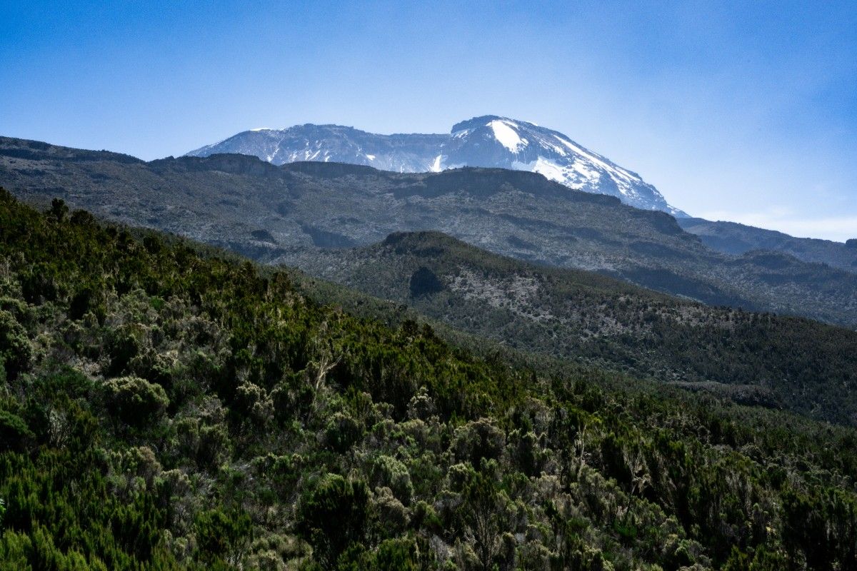
Above the rainforest, between 2,800 and 4,000 metres, lies the heath and moorland zone. This area represents a dramatic transition in the mountain's ecology, where the dense forest gives way to shorter vegetation adapted to the harsher conditions. Giant heathers and lobelias dominate this landscape, creating an otherworldly environment that appears almost prehistoric.
The fauna in this zone becomes notably sparser, though various small mammals and birds still make their home here. The reduced vegetation coverage makes wildlife spotting easier, though animals are generally less abundant than in the lower forests. This zone experiences significant daily temperature fluctuations, which has led to remarkable adaptations among the plant species that survive here.
Alpine Desert Zone
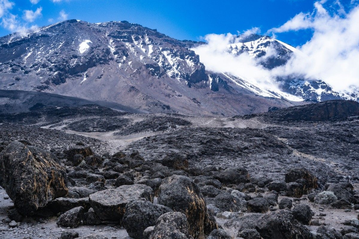
The alpine desert zone, found between 4,000 and 5,000 metres, presents an almost lunar landscape. This harsh environment experiences extreme temperature variations and receives minimal precipitation. The plant life here is highly specialised, consisting mainly of hardy lichens and small, tough plants that can survive the severe conditions.
Despite its apparent barrenness, this zone holds significant scientific interest due to the remarkable adaptations of its few resident species. The dramatic reduction in oxygen at this altitude, combined with intense solar radiation and extreme temperature swings, creates one of the most challenging environments for life on the mountain.
Summit Zone
The summit zone, above 5,000 metres, represents the ultimate test of survival for any organism. This arctic-like environment, characterised by permanent ice and sub-zero temperatures, supports very little visible life. However, even here, microscopic organisms have been discovered surviving in protected niches, demonstrating the remarkable adaptability of life.
This zone features the mountain's famous glaciers, though these are rapidly retreating due to climate change. The loss of these ice fields represents one of the most visible signs of global warming's impact on Mount Kilimanjaro, with significant implications for both the mountain's ecology and its iconic appearance.
Planning Your Kilimanjaro Climb
Time Requirements and Scheduling
One of the most common questions from aspiring climbers is "how long does it take to climb Mount Kilimanjaro" or "how long to climb Mount Kilimanjaro". The answer depends largely on your chosen route and desired acclimatisation time. Most expeditions take between five to nine days, with longer durations offering better acclimatisation and higher success rates. The recommended minimum duration is six days, though seven to eight-day climbs provide better opportunities for proper acclimatisation and a more enjoyable experience.
When planning your ascent, consider that Mount Kilimanjaro trek timing affects not only your climbing experience but also your chances of reaching the summit. The journey includes time for daily hiking, rest periods, meals, and acclimatisation stops. A typical day involves 5-7 hours of walking, though summit day can extend to 12-14 hours. Adding extra days to your itinerary significantly increases your chances of successful acclimatisation and summit achievement.
Cost Considerations
The climb Mount Kilimanjaro price varies significantly depending on several factors. Budget expeditions typically start around £1,500, while premium services can exceed £4,000. These costs usually include park fees, professional guides, porters, accommodation on the mountain, meals during the climb, and rescue fees. Additional expenses include international flights, equipment rental or purchase, visas, vaccinations, and travel insurance.
Understanding the cost structure helps in budgeting appropriately. Park fees alone constitute a significant portion of the total cost, with current rates at approximately $70 per day for adults. Guide and porter services, essential for a safe and comfortable climb, represent another major expense. Quality equipment rental, if needed, adds to the overall cost but remains crucial for safety and comfort during the ascent.
Physical Preparation
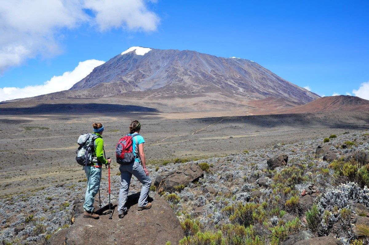
When considering "how difficult is it to climb Mount Kilimanjaro", the answer lies more in altitude challenges than technical climbing difficulty. No specialised climbing skills are required, but good physical fitness proves essential. A comprehensive training programme should begin at least three months before your climb, focusing on cardiovascular endurance, strength training, and hiking practice with a loaded pack.
The physical demands of the climb include walking for extended periods on varying terrain, carrying a daypack, and dealing with altitude effects. Regular training hikes, particularly on hills or mountains if available, help prepare both physically and mentally for the challenge ahead. Including activities that build stamina, such as cycling, swimming, or stair climbing, contributes to overall preparation.
Routes and Climbing Strategies
Popular Routes Overview
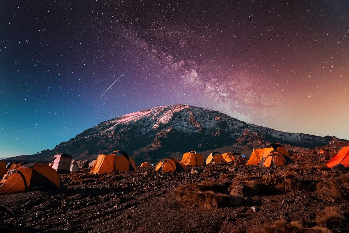
Several established routes lead to Kilimanjaro's summit, each offering unique characteristics and challenges. The Marangu Route, often called the "Coca-Cola Route," provides the only hut accommodation on the mountain and takes a minimum of five days. The Machame Route, nicknamed the "Whiskey Route," offers excellent acclimatisation opportunities over six to seven days and boasts scenic views throughout the journey.
The Lemosho Route, approaching from the west, provides one of the most scenic experiences and excellent acclimatisation over seven to eight days. The Rongai Route, the only northern approach, offers a more remote experience and often encounters less rainfall. Each route presents different advantages and considerations for climbers planning their ascent.
Route Selection Criteria
Choosing the right route depends on several factors, including your experience level, time available, and comfort preferences. Consider the daily distances, elevation gains, camping conditions, and crowd levels when making your selection. The Lemosho and Northern Circuit routes, while longer, offer better acclimatisation profiles and higher success rates. The Marangu Route, though popular, has lower success rates due to its shorter duration and steeper ascent profile.
Route difficulty varies significantly. The Machame Route offers excellent acclimatisation but includes challenging sections like the Barranco Wall. The Rongai Route provides a more gradual ascent but less scenic variety. Understanding these differences helps in selecting the route that best matches your capabilities and preferences.
Summit Strategy
Success on summit day requires careful planning and execution. Most routes schedule the final ascent to begin around midnight, allowing climbers to reach the summit at sunrise and descend before afternoon weather changes occur. This strategy also takes advantage of firmer snow conditions during nighttime hours and provides spectacular sunrise views from the summit.
The final push to the summit involves approximately six to eight hours of steady climbing in cold, dark conditions. Proper layering of clothing, careful pacing, and maintaining adequate hydration and nutrition prove crucial during this phase. Mental preparation plays an equally important role, as the combination of extreme altitude, cold, and fatigue creates a significant challenge.
Cultural Significance and Local Communities
Indigenous Heritage
The cultural landscape surrounding Mount Kilimanjaro stretches back centuries, with the mountain playing a central role in local traditions and beliefs. The Chagga people, who have historically inhabited the mountain's fertile slopes, maintain a rich cultural connection to the peak. Their traditional practices, agricultural techniques, and spiritual beliefs have been shaped by their proximity to this natural wonder, creating a unique cultural heritage that continues to influence life around the mountain today.
Traditional Chagga agricultural systems demonstrate remarkable adaptation to the mountain's environment, combining coffee cultivation with banana trees in a sustainable agroforestry system. This agricultural heritage represents generations of accumulated knowledge about Mount Kilimanjaro's unique ecological conditions. The Chagga people's understanding of the mountain's weather patterns, soil conditions, and seasonal changes has allowed them to develop sophisticated farming techniques that continue to support local communities.
Modern Economic Impact
Today, Mount Kilimanjaro serves as a crucial economic resource for local communities. The tourism industry surrounding the mountain provides significant employment opportunities, from guiding and portering services to hospitality and support roles. The question of "how long will it take to climb Mount Kilimanjaro" often leads to discussions about the importance of local expertise, as experienced guides and porters prove essential for safe and successful ascents.
The economic benefits extend beyond direct tourism services. Local markets, equipment rental shops, and transportation services all contribute to the mountain's economic ecosystem. However, this economic reliance on tourism also presents challenges, particularly during global events that affect travel patterns. Communities have worked to develop diverse income sources while maintaining their traditional connection to the mountain.
Cultural Preservation Efforts
Efforts to preserve local cultural heritage while adapting to modern tourism demands represent an ongoing challenge. Local communities maintain traditional customs and celebrations related to the mountain while participating in the contemporary tourism economy. Cultural education programmes help ensure younger generations understand and appreciate their heritage, even as they engage with modern opportunities presented by the mountain's global appeal.
Conservation and Future Challenges
Environmental Preservation
Among the most pressing facts about Mount Kilimanjaro in Africa is the rapid retreat of its iconic glaciers. Climate change poses a significant threat to the mountain's ecosystems, with glacial ice that has existed for thousands of years disappearing at an alarming rate. These changes affect not only the mountain's appearance but also local water resources and ecosystem stability.
Conservation efforts focus on protecting the mountain's diverse environments while managing the impact of tourism. Mount Kilimanjaro National Park authorities implement various measures to balance accessibility with preservation, including strict waste management policies, designated camping areas, and limitations on daily climber numbers.
Sustainable Tourism
The growing popularity of trekking Mount Kilimanjaro presents both opportunities and challenges for conservation efforts. Sustainable tourism practices have become increasingly important as visitor numbers rise. Park authorities work to manage tourist impact through various measures, including trail maintenance, waste removal systems, and education programmes for visitors and tour operators.
The challenge of maintaining the delicate balance between tourism access and environmental protection requires continuous adaptation of management strategies. This includes developing new approaches to handle increasing visitor numbers while preserving the mountain's ecological integrity and cultural significance.
Future Outlook
Looking ahead, Mount Kilimanjaro faces various challenges that will require innovative solutions. Climate change continues to threaten the mountain's unique ecosystems, while growing tourism pressure demands careful management. Future conservation strategies must address these challenges while ensuring the mountain remains accessible for future generations.
Water resource management represents another critical challenge, as changing climate patterns affect traditional water sources. Local communities and conservation authorities work together to develop sustainable water management practices that can adapt to these changes while supporting both human needs and ecosystem health.
Research and monitoring programmes play a crucial role in understanding and addressing these challenges. Scientific studies track changes in the mountain's ecosystems, helping inform conservation strategies and adaptation measures. This research also provides valuable insights into global climate change impacts, making Mount Kilimanjaro an important indicator of broader environmental changes.
Related Articles

Let us know you agree to cookies
We use marketing, analytical and functional cookies as well as similar technologies to give you the best experience. Third parties, including social media platforms, often place tracking cookies on our site to show you personalised adverts outside of our website.
We store your cookie preferences for two years and you can edit your preferences via ‘manage cookies’ or through the cookie policy at the bottom of every page. For more information, please see our cookie policy.
